

- KITCHEN &
LAUNDRY - HOME &
GARDEN - TECHNOLOGY
& GAMING - HEALTH BEAUTY
& FITNESS - OFFICE &
COMPUTERS - KIDS NURSERY
& TOYS - CARS DIY
& OUTDOORS - MENS
CLOTHING - WOMENS
CLOTHING - HOLIDAYS
& TRAVEL - EBAY LOCAL
DEALS
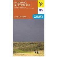
Ordnance Survey Explorer OL 33 Haslemere & Petersfield Map, Orange/D
Non-Fiction
BEST OFFER
| BEST OFFER SUMMARY | |||
|---|---|---|---|
| Delivery: | Unknown | Brand: | ORDNANCE SURVEY |
| Deal found: | 2+ weeks ago | EAN: | 9780319242728 |
| Checked: | Yesterday | Status: | In Stock |
| Share deal: |


|
||
| Email alert: | |||
| Price History: (902 days) | N/A | Low: High: | £5.40 £6.50 |
| Shop: | Promo: | Price checked: | Delivery: | Price: | Link: |
|---|---|---|---|---|---|
|
|
Yesterday | See website | £6.50Unknown P&P | Go to offer | |
|
|
60 minutes ago | £1.00 | £10.50 + £1.00 P&P | Go to offer | |
| * Condition: New | |||||
|
|
19 hours ago | Free | £12.99 | Go to offer | |
| See website | --.-- | Check Site | |||
The essential map for outdoor activities in Haslemere and Petersfield. The OS Explorer Map is the Ordnance Survey's most detailed folding map and is recommended for anyone enjoying outdoor activities including walking, horse riding and off-road cycling. This map now comes with a digital version which you can download to your smartphone or tablet.FeaturesSouth DownsSussex Border PathGreensand WayHangers WayHampshireSurreyWest SussexAltonHaslemereMidhurstPetersfield1:25 000 scale (4 cm to 1 km ' 2.5 inches to 1 mile)This map comes with a digital version which you can download to your smartphone or tablet - Manufacturers part number: 4384
SIMILAR ITEMS:
Getting related products...