

- KITCHEN &
LAUNDRY - HOME &
GARDEN - TECHNOLOGY
& GAMING - HEALTH BEAUTY
& FITNESS - OFFICE &
COMPUTERS - KIDS NURSERY
& TOYS - CARS DIY
& OUTDOORS - MENS
CLOTHING - WOMENS
CLOTHING - HOLIDAYS
& TRAVEL - EBAY LOCAL
DEALS
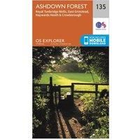
Ordnance Survey Explorer 135 Ashdown Forest Map With Digital Version, Orange
Christmas Gifts
| BEST OFFER SUMMARY | ||||
|---|---|---|---|---|
| Delivery: | Unknown | Brand: | ORDNANCE SURVEY | |
| Deal found: | 2+ weeks ago | EAN: | 9780319243282 | |
| Checked: | 73 minutes ago | Status: | In Stock | |
| Share deal: |


|
|||
| Email alert: | ||||
| Price History: (902 days) | N/A | Low: High: | £5.40 £6.50 | |
| FEATURES | ||||
Size: One Size Colour: Black | ||||
| Shop: | Promo: | Price checked: | Delivery: | Price: | Link: |
|---|---|---|---|---|---|
|
|
73 minutes ago | See website | £6.50Unknown P&P | Go to offer | |
|
|
60 minutes ago | Free | £8.99 | Go to offer | |
| * Eligible for Prime | |||||
|
|
63 minutes ago | Free | £12.99 | Go to offer | |
| See website | --.-- | Check Site | |||
The essential map for outdoor activities in Ashdown Forest. The OS Explorer Map is the Ordnance Survey's most detailed folding map and is recommended for anyone enjoying outdoor activities including walking, horse riding and off-road cycling. This map now comes with a digital version which you can download to your smartphone or tablet.Providing complete GB coverage, the OS Explorer map series details information essential in the great outdoors, including youth hostels, pubs and visitor information. Rights of way, fences, permissive paths and bridleways are clearly shown, ensuring you have the best information to get the most out of your time in the countryside.FeaturesForest Way (East Sussex)Sussex Border PathWealdwayWorth Way (West Sussex)Vanguard WayTunbridge Wells Circular Walk (formerly High Weald Walk)Cuckoo TrailHigh Weald Landscape TrailEast SussexWest Sussex East GrinsteadHaywards HeathRoyal Tunbridge WellsUckfield1:25 000 scale (4 cm to 1 km ' 2.5 inches to 1 mile)This map com... - Manufacturers part number: 4639
SIMILAR ITEMS: