

- KITCHEN &
LAUNDRY - HOME &
GARDEN - TECHNOLOGY
& GAMING - HEALTH BEAUTY
& FITNESS - OFFICE &
COMPUTERS - KIDS NURSERY
& TOYS - CARS DIY
& OUTDOORS - MENS
CLOTHING - WOMENS
CLOTHING - HOLIDAYS
& TRAVEL - EBAY LOCAL
DEALS
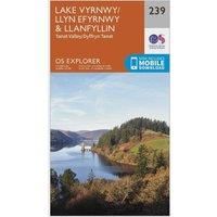
Ordnance Survey Explorer 239 Lake Vyrnwy & Llanfyllin Map With Digital Version, Orange
Christmas Gifts
£11.20
GO TO OFFER| BEST OFFER SUMMARY | |||
|---|---|---|---|
| Delivery: | FREE | Brand: | ORDNANCE SURVEY |
| Deal found: | Yesterday | EAN: | 9780319244326 |
| Checked: | 60 minutes ago | Status: | In Stock |
| Share deal: |


|
||
| Shop: | Promo: | Price checked: | Delivery: | Price: | Link: |
|---|---|---|---|---|---|
|
|
60 minutes ago | Free | £11.20 | Go to offer | |
| * Condition: New | |||||
|
|
Yesterday | Free | £12.99 | Go to offer | |
| See website | --.-- | Check Site | |||
The essential map for outdoor activities in Lake Vyrnwy and Llanfyllin. The OS Explorer Map is the Ordnance Survey's most detailed folding map and is recommended for anyone enjoying outdoor activities including walking, horse riding and off-road cycling. This map now comes with a digital version which you can download to your smartphone or tablet.Providing complete GB coverage, the OS Explorer map series details information essential in the great outdoors, including youth hostels, pubs and visitor information. Rights of way, fences, permissive paths and bridleways are clearly shown, ensuring you have the best information to get the most out of your time in the countryside.FeaturesPererindod Melangell Walk Ann Griffiths WalkGlyndwr's Way (National Trail) PowysClwyd1:25 000 scale (4 cm to 1 km ' 2.5 inches to 1 mile)This map comes with a digital version which you can download to your smartphone or tablet.Go to OS.uk/redeem for more details (terms and conditions apply).Scratch off the pan... - Manufacturers part number: 4947
SIMILAR ITEMS: