

- KITCHEN &
LAUNDRY - HOME &
GARDEN - TECHNOLOGY
& GAMING - HEALTH BEAUTY
& FITNESS - OFFICE &
COMPUTERS - KIDS NURSERY
& TOYS - CARS DIY
& OUTDOORS - MENS
CLOTHING - WOMENS
CLOTHING - HOLIDAYS
& TRAVEL - EBAY LOCAL
DEALS
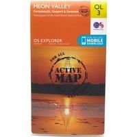
Ordnance Survey Explorer OL 3 Active D Meon Valley Map, Orange/D
Maps & Atlases
| BEST OFFER SUMMARY | ||||
|---|---|---|---|---|
| Delivery: | Unknown | Brand: | ORDNANCE SURVEY | |
| Deal found: | 2+ weeks ago | EAN: | 9780319469217 | |
| Checked: | 6 hours ago | Status: | In Stock | |
| Share deal: |


|
|||
| Email alert: | ||||
| Price History: (912 days) | N/A | Low: High: | £8.50TODAY! £9.60 | |
| FEATURES | ||||
Size: One Size Colour: Black | ||||
| Shop: | Promo: | Price checked: | Delivery: | Price: | Link: |
|---|---|---|---|---|---|
|
|
6 hours ago | See website | £8.50Unknown P&P | Go to offer | |
|
|
60 minutes ago | Free | £13.39 | Go to offer | |
| * Eligible for Prime | |||||
|
|
60 minutes ago | Free | £14.65 | Go to offer | |
| * Condition: New | |||||
|
|
83 minutes ago | Free | £16.99 | Go to offer | |
Map sheet number OL 3 in the detailed OS Explorer weatherproof Map series gives you the tools to discover the wealth of naval history that Portsmouth offers. The new replacement for the Explorer 119 map, the OL 3 covers the same area from Portsmouth stretching north through Fareham, Waterlooville, Droxford and Owslebury. The map also takes in a south westerly section of the South Downs National Park.FeaturesDetailed and easy to read map from Ordnance SurveyScale: 1:25,000Covers Portsmouth, Gosport, Fareham, Waterlooville, Droxford, Owslebury, part of the South Downs Trail, Solent Way, Kings Way, Pilgrim's Trail and Wayfarers WalkIncludes mobile download of map for use on your smartphoneShows tourist information points, popular sites, viewpo... - Manufacturers part numbers: 42423482|4261
SIMILAR ITEMS: