

- KITCHEN &
LAUNDRY - HOME &
GARDEN - TECHNOLOGY
& GAMING - HEALTH BEAUTY
& FITNESS - OFFICE &
COMPUTERS - KIDS NURSERY
& TOYS - CARS DIY
& OUTDOORS - MENS
CLOTHING - WOMENS
CLOTHING - HOLIDAYS
& TRAVEL - EBAY LOCAL
DEALS
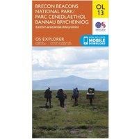
Ordnance Survey Explorer OL 13 Brecon Beacons National Park - Eastern Area Map, D/D
Maps & Atlases
| BEST OFFER SUMMARY | |||
|---|---|---|---|
| Delivery: | Unknown | Brand: | ORDNANCE SURVEY |
| Deal found: | 2+ weeks ago | EAN: | 9780319242520 |
| Checked: | 9 hours ago | Status: | In Stock |
| Share deal: |


|
||
| Email alert: | |||
| Price History: (250 days) | N/A | Low: High: | £7.80TODAY! £7.80 |
| Shop: | Promo: | Price checked: | Delivery: | Price: | Link: |
|---|---|---|---|---|---|
|
|
9 hours ago | See website | £7.80Unknown P&P | Get offer | |
|
|
1 minute ago | Free | £11.50 | Get offer | |
| * Condition: New | |||||
| See website | --.-- | Check Site | |||
The essential map for outdoor activities in Brecon Beacons National Park - Eastern area. The OS Explorer Map is the Ordnance Survey's most detailed folding map and is recommended for anyone enjoying outdoor activities including walking, horse riding and off-road cycling. This map now comes with a digital version which you can download to your smartphone or tablet.FeaturesOffa's Dyke PathWye Valley Walk (Guide Book)Rhymney Valley Ridgeway FootpathUsk Valley WalkSirhowy Valley WalkThree Castles WalkTaff TrailEbbw Valley WalkMarches Way (Delete from mapping)Offa's Dyke Path (National Trail)Abergavenny/Y FenniHay-on-WyeBrecon Beacons National ParkPowysHereford and WorcesterGwent1:25 000 scale (4 cm to 1 km ' 2.5 inches to 1 mile) - Manufacturers part number: 15894262
SIMILAR ITEMS: