

- KITCHEN &
LAUNDRY - HOME &
GARDEN - TECHNOLOGY
& GAMING - HEALTH BEAUTY
& FITNESS - OFFICE &
COMPUTERS - KIDS NURSERY
& TOYS - CARS DIY
& OUTDOORS - MENS
CLOTHING - WOMENS
CLOTHING - HOLIDAYS
& TRAVEL - EBAY LOCAL
DEALS
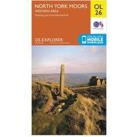
Ordnance Survey Explorer OL 26 North York Moors Map (Western Area), Orange/D
Maps & Atlases
| BEST OFFER SUMMARY | |||
|---|---|---|---|
| Delivery: | Unknown | Brand: | ORDNANCE SURVEY |
| Deal found: | 2+ weeks ago | EAN: | 9780319242650 |
| Checked: | 9 hours ago | Status: | In Stock |
| Share deal: |


|
||
| Email alert: | |||
| Price History: (250 days) | N/A | Low: High: | £7.80TODAY! £7.80 |
| Shop: | Promo: | Price checked: | Delivery: | Price: | Link: |
|---|---|---|---|---|---|
|
|
9 hours ago | See website | £7.80Unknown P&P | Get offer | |
|
|
1 minute ago | Free | £10.96 | Get offer | |
| * Condition: New | |||||
| See website | --.-- | Check Site | |||
The Explorer OL 26 from Ordnance Survey covers the western area of the spectacular North York Moors National Park including the Cleveland Hills and Hambleton Hills. Visit the beautiful seaside retreat of Saltburn-by-the-Sea or move inland through the Community Tees Forest into the North York Moors National Park and navigate the many trails which work their way along Cleveland Hills and the Hambleton Hills.FeaturesDetailed and informative explorer map of the North York Moors (western area) from Ordnance SurveyCovers the Cleveland Hills, Hambleton Hills, Saltburn-by-the-Sea, Guisborough, Helmsley, Roseberry Topping and a small section of the Howardian HillsScale: 1:25000Now includes Mobile DownloadRecommended activity - walking / hiking / cyc... - Manufacturers part number: 15894283
SIMILAR ITEMS: