

- KITCHEN &
LAUNDRY - HOME &
GARDEN - TECHNOLOGY
& GAMING - HEALTH BEAUTY
& FITNESS - OFFICE &
COMPUTERS - KIDS NURSERY
& TOYS - CARS DIY
& OUTDOORS - MENS
CLOTHING - WOMENS
CLOTHING - HOLIDAYS
& TRAVEL - EBAY LOCAL
DEALS
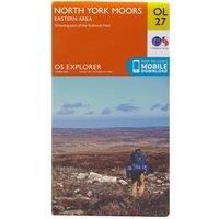
OS Explorer OL27 North York Moors - Eastern area (OS Explorer Map)
Maps & Atlases
BEST OFFER
| BEST OFFER SUMMARY | |||
|---|---|---|---|
| Delivery: | Unknown | Brand: | ORDNANCE SURVEY |
| Deal found: | 2+ weeks ago | EAN: | 9780319242667 |
| Checked: | 9 hours ago | Status: | In Stock |
| Share deal: |


|
||
| Email alert: | |||
| Price History: (250 days) | N/A | Low: High: | £7.80TODAY! £7.80 |
| Shop: | Promo: | Price checked: | Delivery: | Price: | Link: |
|---|---|---|---|---|---|
|
|
9 hours ago | See website | £7.80Unknown P&P | Get offer | |
|
|
1 minute ago | Free | £10.25 | Get offer | |
| * Condition: New | |||||
| See website | --.-- | Check Site | |||
The Explorer OL 27 from Ordnance Survey covers the eastern area of the spectacular North York Moors National Park including the Cleveland Hills and Hambleton Hills. Take the beautiful seaside retreats of Whitby and Scarborough or make your way inland and discover the many trails which can be used to navigate the National Park.FeaturesDetailed and informative explorer map of the North York Moors (eastern area) from Ordnance SurveyCovers the Cleveland Hills, Hambleton Hills, Tabular Hills Walk, Cleveland Street, Esk Valley Walk and the northern end of Ebor WayScale: 1:25000Now includes Mobile DownloadRecommended activity - walking / hiking / cycling / navigation / expedition - Manufacturers part number: 15894285
SIMILAR ITEMS:
Getting related products...