

- KITCHEN &
LAUNDRY - HOME &
GARDEN - TECHNOLOGY
& GAMING - HEALTH BEAUTY
& FITNESS - OFFICE &
COMPUTERS - KIDS NURSERY
& TOYS - CARS DIY
& OUTDOORS - MENS
CLOTHING - WOMENS
CLOTHING - HOLIDAYS
& TRAVEL - EBAY LOCAL
DEALS
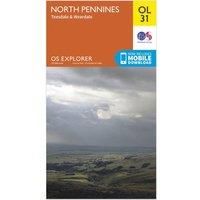
Ordnance Survey Explorer OL 31 North Pennines - Teesdale & Weardale Map, Orange
Maps & Atlases
BEST OFFER
| BEST OFFER SUMMARY | |||
|---|---|---|---|
| Delivery: | Unknown | Brand: | ORDNANCE SURVEY |
| Deal found: | 2+ weeks ago | EAN: | 9780319242704 |
| Checked: | 9 hours ago | Status: | In Stock |
| Share deal: |


|
||
| Email alert: | |||
| Price History: (250 days) | N/A | Low: High: | £7.80TODAY! £7.80 |
| Shop: | Promo: | Price checked: | Delivery: | Price: | Link: |
|---|---|---|---|---|---|
|
|
9 hours ago | See website | £7.80Unknown P&P | Get offer | |
|
|
1 minute ago | Free | £11.95 | Get offer | |
| * Condition: New | |||||
| See website | --.-- | Check Site | |||
The essential map for outdoor activities in North Pennines - Teesdale and Weardale. The OS Explorer Map is the Ordnance Survey's most detailed folding map and is recommended for anyone enjoying outdoor activities including walking, horse riding and off-road cycling. This map now comes with a digital version which you can download to your smartphone or tablet.FeaturesPennine WayWeardale WayTeesdale WaySouth Tyne TrailPennine Way (National Trail)E2 (European Long Distance Route)Barnard CastleDurhamCumbriaNorthumberland1:25 000 scale (4 cm to 1 km ' 2.5 inches to 1 mile)This map comes with a digital version which you can download to your smartphone or tablet. - Manufacturers part number: 15894295
SIMILAR ITEMS:
Getting related products...