

- KITCHEN &
LAUNDRY - HOME &
GARDEN - TECHNOLOGY
& GAMING - HEALTH BEAUTY
& FITNESS - OFFICE &
COMPUTERS - KIDS NURSERY
& TOYS - CARS DIY
& OUTDOORS - MENS
CLOTHING - WOMENS
CLOTHING - HOLIDAYS
& TRAVEL - EBAY LOCAL
DEALS
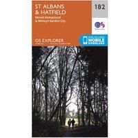
Ordnance Survey Explorer 182 St Albans & Hatfield Map With Digital Version, Orange
Christmas Gifts
| BEST OFFER SUMMARY | |||
|---|---|---|---|
| Delivery: | Unknown | Brand: | ORDNANCE SURVEY |
| Deal found: | 2+ weeks ago | EAN: | 9780319243756 |
| Checked: | 3 hours ago | Status: | In Stock |
| Share deal: |


|
||
| Email alert: | |||
| Price History: (256 days) | N/A | Low: High: | £7.80TODAY! £7.80 |
| Shop: | Promo: | Price checked: | Delivery: | Price: | Link: |
|---|---|---|---|---|---|
|
|
3 hours ago | See website | £7.80Unknown P&P | Get offer | |
|
|
1 minute ago | Free | £12.08 | Get offer | |
| * Condition: New | |||||
| See website | --.-- | Check Site | |||
The essential map for outdoor activities in St Albans and Hatfield. The OS Explorer Map is the Ordnance Survey's most detailed folding map and is recommended for anyone enjoying outdoor activities including walking, horse riding and off-road cycling. This map now comes with a digital version which you can download to your smartphone or tablet.Providing complete GB coverage, the OS Explorer map series details information essential in the great outdoors, including youth hostels, pubs and visitor information. Rights of way, fences, permissive paths and bridleways are clearly shown, ensuring you have the best information to get the most out of your time in the countryside.FeaturesIcknield Way Icknield Way PathVer-Colne Valley Walk Nicky LineGrand Union Canal WalkChain WalkUpper Lea Valley Walk Hertfordshire WayAlban Way Chiltern Way Watling Chase Trail BedfordshireHertfordshire Hatfield Hemel Hempstead St AlbansWelwyn Garden City1:25 000 scale (4 cm to 1 km ' 2.5 inches to 1 mile)This m... - Manufacturers part number: 15894449
SIMILAR ITEMS: