

- KITCHEN &
LAUNDRY - HOME &
GARDEN - TECHNOLOGY
& GAMING - HEALTH BEAUTY
& FITNESS - OFFICE &
COMPUTERS - KIDS NURSERY
& TOYS - CARS DIY
& OUTDOORS - MENS
CLOTHING - WOMENS
CLOTHING - HOLIDAYS
& TRAVEL - EBAY LOCAL
DEALS
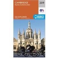
Cambridge Map | Royston, Duxford & Linton | Ordnance Survey | OS Explorer Map 209 | England | Walks | Hiking | Maps | Adventure
Travel Atlases & Maps
| BEST OFFER SUMMARY | |||
|---|---|---|---|
| Delivery: | Unknown | Brand: | ORDNANCE SURVEY |
| Deal found: | 2+ weeks ago | EAN: | 9780319244029 |
| Checked: | 13 hours ago | Status: | In Stock |
| Share deal: |


|
||
| Email alert: | |||
| Price History: (254 days) | N/A | Low: High: | £7.80TODAY! £7.80 |
| Shop: | Promo: | Price checked: | Delivery: | Price: | Link: |
|---|---|---|---|---|---|
|
|
13 hours ago | See website | £7.80Unknown P&P | Get offer | |
|
|
1 minute ago | Free | £11.73 | Get offer | |
| * Condition: New | |||||
| See website | --.-- | Check Site | |||
The essential map for outdoor activities in Cambridge, Royston, Duxford and Linton. The OS Explorer Map is the Ordnance Survey's most detailed folding map and is recommended for anyone enjoying outdoor activities including walking, horse riding and off-road cycling. This map now comes with a digital version which you can download to your smartphone or tablet.Providing complete GB coverage, the OS Explorer map series details information essential in the great outdoors, including youth hostels, pubs and visitor information. Rights of way, fences, permissive paths and bridleways are clearly shown, ensuring you have the best information to get the most out of your time in the countryside.FeaturesIcknield Way Harcamlow Way Wimpole Way Icknield Way Path Clopton WayFen Rivers WayPathfinder Long Distance WalkHertfordshire WayE2 (European Long Distance Route) Cambridgeshire HertfordshireEssex Cambridge1:25 000 scale (4 cm to 1 km ' 2.5 inches to 1 mile)This map comes with a digital version whi... - Manufacturers part number: 15894476
SIMILAR ITEMS: