

- KITCHEN &
LAUNDRY - HOME &
GARDEN - TECHNOLOGY
& GAMING - HEALTH BEAUTY
& FITNESS - OFFICE &
COMPUTERS - KIDS NURSERY
& TOYS - CARS DIY
& OUTDOORS - MENS
CLOTHING - WOMENS
CLOTHING - HOLIDAYS
& TRAVEL - EBAY LOCAL
DEALS
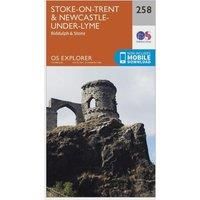
Ordnance Survey Explorer 258 Stoke-on-Trent & Newcastle-under-Lyme Map With Digital Version, Orange
In-Car Entertainment
| BEST OFFER SUMMARY | |||
|---|---|---|---|
| Delivery: | Unknown | Brand: | ORDNANCE SURVEY |
| Deal found: | 2+ weeks ago | EAN: | 9780319244555 |
| Checked: | 7 hours ago | Status: | In Stock |
| Share deal: |


|
||
| Email alert: | |||
| Price History: (256 days) | N/A | Low: High: | £7.80TODAY! £7.80 |
| Shop: | Promo: | Price checked: | Delivery: | Price: | Link: |
|---|---|---|---|---|---|
|
|
7 hours ago | See website | £7.80Unknown P&P | Get offer | |
|
|
1 minute ago | Free | £10.75 | Get offer | |
| * Condition: New | |||||
| See website | --.-- | Check Site | |||
The essential map for outdoor activities in Stoke-on-Trent and Newcastle-under-Lyme. The OS Explorer Map is the Ordnance Survey's most detailed folding map and is recommended for anyone enjoying outdoor activities including walking, horse riding and off-road cycling. This map now comes with a digital version which you can download to your smartphone or tablet.Providing complete GB coverage, the OS Explorer map series details information essential in the great outdoors, including youth hostels, pubs and visitor information. Rights of way, fences, permissive paths and bridleways are clearly shown, ensuring you have the best information to get the most out of your time in the countryside.FeaturesGritstone TrailStaffordshire Moorlands Walks Staffordshire WaySouth Cheshire WayCheshire Ring Canal Walk StaffordshireLeekNewcastle-under-Lyme Stoke-on-TrentStone1:25 000 scale (4 cm to 1 km ' 2.5 inches to 1 mile)This map comes with a digital version which you can download to your smartphone or ... - Manufacturers part number: 15894564
SIMILAR ITEMS: