

- KITCHEN &
LAUNDRY - HOME &
GARDEN - TECHNOLOGY
& GAMING - HEALTH BEAUTY
& FITNESS - OFFICE &
COMPUTERS - KIDS NURSERY
& TOYS - CARS DIY
& OUTDOORS - MENS
CLOTHING - WOMENS
CLOTHING - HOLIDAYS
& TRAVEL - EBAY LOCAL
DEALS
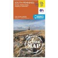
Ordnance Survey Explorer OL 21 Active D South Pennies Map, Orange
In-Car Entertainment
| BEST OFFER SUMMARY | |||
|---|---|---|---|
| Delivery: | Unknown | Brand: | ORDNANCE SURVEY |
| Deal found: | 2+ weeks ago | EAN: | 9780319469392 |
| Checked: | 4 hours ago | Status: | In Stock |
| Share deal: |


|
||
| Email alert: | |||
| Price History: (256 days) | N/A | Low: High: | £10.20TODAY! £10.20 |
Map sheet number OL 21 in the detailed OS Explorer weatherproof Map series covers a beautiful area of the Pennines and includes Burnley, Hebdem Bridge, Todmorden and Keighley. Designed to help you to navigate in all weathers, the OL 21 Map gives you the tools to discover this areas highest peak, Lad Law at 517m, and shows the many footpaths which criss-cross the landscape.FeaturesDetailed and easy to read map from Ordnance SurveyScale: 1:25,000Covers Burnley, Hebdem Bridge, Todmorden and KeighleyIncludes mobile download of map for use on your smartphoneShows tourist information points, popular sites, viewpoints, places of information and rights of way informationRecommended activity - navigation - Manufacturers part numbers: 15894275|unknown
- New Store Stock
SIMILAR ITEMS: