

- KITCHEN &
LAUNDRY - HOME &
GARDEN - TECHNOLOGY
& GAMING - HEALTH BEAUTY
& FITNESS - OFFICE &
COMPUTERS - KIDS NURSERY
& TOYS - CARS DIY
& OUTDOORS - MENS
CLOTHING - WOMENS
CLOTHING - HOLIDAYS
& TRAVEL - EBAY LOCAL
DEALS
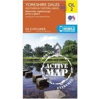
Yorkshire Dales South & Western (OS Explorer Active Map)
Travel Atlases & Maps
| BEST OFFER SUMMARY | |||
|---|---|---|---|
| Delivery: | Unknown | Brand: | ORDNANCE SURVEY |
| Deal found: | 2+ weeks ago | EAN: | 9780319475331 |
| Checked: | 2 hours ago | Status: | In Stock |
| Share deal: |


|
||
| Email alert: | |||
| Price History: (254 days) | N/A | Low: High: | £10.20TODAY! £10.20 |
| Shop: | Promo: | Price checked: | Delivery: | Price: | Link: |
|---|---|---|---|---|---|
|
|
2 hours ago | See website | £10.20Unknown P&P | Get offer | |
|
|
1 minute ago | Free | £14.65 | Get offer | |
| * Condition: New | |||||
| See website | --.-- | Check Site | |||
The OS Explorer map of Yorkshire Dales, Southern & Western area, including Whernside, Ingleborough, & Pen-y-ghent.Whether you're looking to take on all three peaks or just looking for a hike through the South-West of the dales, this map is a must-have.With Explorer OL2 you can easily take on the Yorkshire Three Peaks circular route. The total walking distance is 24.5 miles (39.2km), and you can start at Horton-in-Ribblesdales, Ribblehead, or Chapel le Dale, with the circular route finishing at the point you begin.Our OS Explorer maps are perfect for day-tripping, extensive hikes, and cycling. They come in both standard and Weatherproof Active, so you'll never get caught out in a storm. Publication Date: 05/09/2016 - Manufacturers part number: 15894291
SIMILAR ITEMS: